
 I’ve made several trips into the Sipsey over the past few years. My wife, Donna, and I have one previous trek together in our repertoire. In 2010, we made the short nine-mile loop from Thompson Creek Trailhead to the Bee Branch Falls and back. It was a leisurely trip of two nights camping, with plenty of time to enjoy the beauty of the trails.
We knew this one would be a rather ambitious hike, more than doubling our mileage from the previous trip, but we were game for it. We left Tupelo, MS for the 90 minute drive over.
Click on any image in this blog for a larger view.
Day One
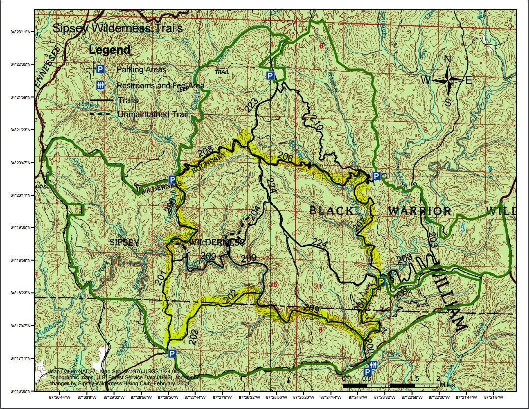
We unloaded our gear at the Randolph Trailhead at 10:00am. My pack weighed in at around 40 lbs., Donna’s at 25 lbs. Heading down FS201, we were in about 1/4 mile when I realized I had left the map on top of the vehicle. We could have made it without a map, but a quick jog back for it was a good move, as several hikers we met along the trail benefited from looking at it.
Our initial walk was pleasant and unimpeded, so we made good time to the junction with FS206 and 209. Packs off for a few minutes while we looked for the old cabin we had read about. After about 20 minutes of searching, we still couldn’t find it.
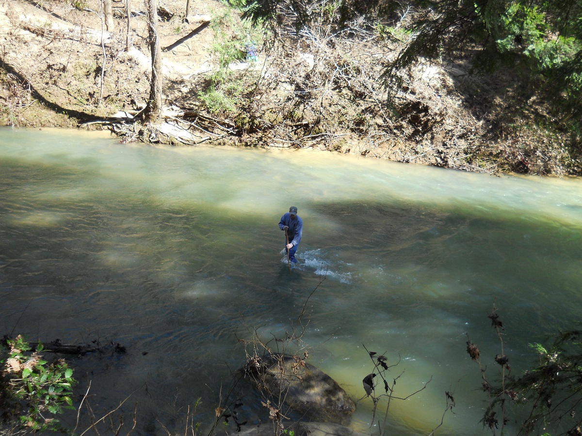 Heading down a rock outcropping on FS206, we stopped at the bottom to have lunch, and then hiked east to the FS209 junction sign before crossing the Sipsey Fork River. Why is it that you always think there’s a “better place to cross” just around the corner? Haha. The water was thigh deep, swift and cold! We gave ourselves 30 minutes to dry our feet and recoup.
North along FS 206 was uneventful. We passed several groups heading south. At one point, we did encounter a small, harmless Ringneck snake. We nudged him off the main trail and went on our way. I’m glad we did, because the kids we passed later on looked like city dwellers and seeing a snake might not have been good for its longevity.
By 3:30pm, we reached the Thompson Creek trailhead and considered camping there for the night. The river crossing was not difficult, but it had drained us a bit physically. Since our goal of reaching the mountain top on FS208 would keep us on schedule, we drew a deep breath and slowly proceeded uphill for the next mile or so to the first camping spot.
Along the way, we met a lone hunter coming out of the woods. Feral hogs are becoming a nuisance, so the Forest Service has opened a hunting season. This fellow said he got within 80 yards of a small pack of hogs, but missed his shots. It was a comfortable experience meeting a fellow with a rifle in the middle of the wilderness and having no apprehension. Alabama folks are just good people.
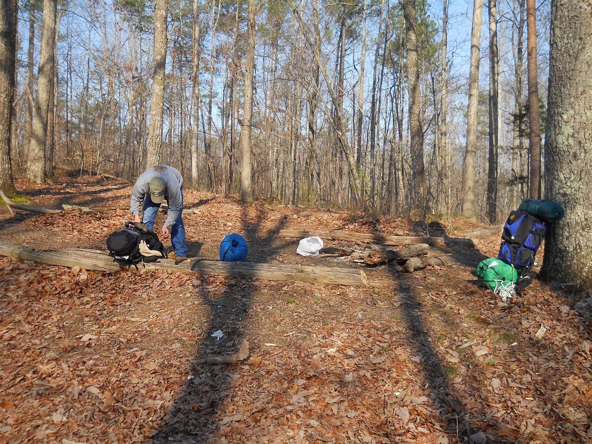 We arrived at the campsite with only a few minutes of daylight left. Fortunately, for us, it appeared no one had camped there for a while, so the firewood from downed limbs was plentiful. We set camp, enjoyed our Lasagna w/meat sauce meal, warmed to the fire till around 8:00pm, and climbed into the tent.
The predicted low was 38 degrees, with clear skies. Donna was bundled up in multi-layers of clothes and “Hot Hands” in her sleeping bag, but I found that a pair of shorts and t-shirt were plenty for me in our 40 degree-rated bags.
The ground was hard and neither of us got a comfortable and complete night’s rest, despite being worn out from the long day. It was amazingly calm and quiet. I thought we might hear the occasional falling of a dead limb, howling of coyotes, or the grunt of feral hogs, but they never came. Nothing stirred, except for the short-lived hooting of a distant owl sometime during the night.
Day Two
Awake at first light, we stayed in our sleeping bags until the sun’s rays broke over the horizon and we could feel their warmth melting into the tent. I prepared Donna a cup of hot oatmeal, while I enjoyed a few slices of pre-cooked bacon and a banana.
At 8:30am, we had broken camp and were ready to begin a long day on the trail. We continued east on FS208 for another mile until its junction with FS 223. I was surprised by the loud croaking of frogs as we approached the junction. On the top of this mountain was a shallow quarter-acre sized pond about 18 inches deep. The water had a rich brown tone from the seasons of leaves and appeared completely undisturbed for years despite the large hog population.
 After a short “packs off” break, we continued on FS208 for one mile and connected with FS224. This five mile trail, heading south, is “downhill all the way!” We enjoyed the relief from climbing, however the washout down the middle of the narrow trail left loose rocks, requiring a lot of attention to footing. Nonetheless, it was an enjoyable trek through the small pines lining both sides of the single-file trail.
We met numerous hikers treading the long, arduous hill (for them) in a day hike to Bee Branch Falls. Many were glad to stop and catch their breath, so Donna and I were happy to oblige them with a short visit. Most of them wanted to know, “How much further?” Somewhere along the trail, Donna and I took time for lunch, each enjoying a tuna and cracker pack, with chocolate bars for dessert.
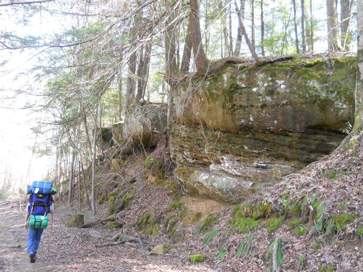
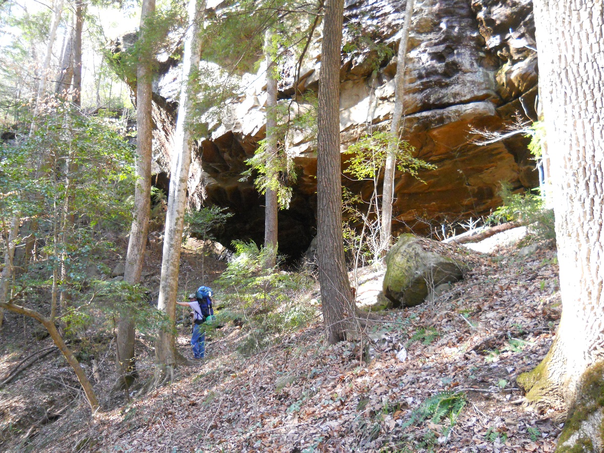
During our lunch break, we stopped to plug in coordinates on our GPS. We had printed off several Geocaches and found the first one easily. However, time was becoming an issue and we needed to keep moving to make our distance goal for the day, so we skipped the rest. The last quarter mile was a beautiful conglomerate of bluffs on our right side and the meandering river valley on our left.
 When we reached the Borden Creek trailhead bridge, we dispatched our packs and hiking boots for a few minutes. Walking downhill put a few “hot spots” on the tips of our toes, so we were glad to give them some fresh air.
While resting, we watched a group of four college-aged boys and one middle-aged adult cross the bridge on their way up the hill. We were shocked by their ill-preparedness. One young fellow had a backpack, but also had both arms wrapped around a huge rucksack in front. Another guy was carrying two gallon jugs of water, along with his pack. We quietly chuckled at the boy with the package of hot dog buns strapped tightly to his pack. They weren’t on the trail yet and the package was smashed near flat. We knew they were in for a hard, long haul.
Decision time: take the well-traveled east side of FS200 and face crossing Borden creek, or take the west side and face the unknown. Donna didn’t like the idea of having to cross the river again. The water level was definitely one of our concerns, so we opted for what we thought would be the lesser of two evils…the unknown, but hopeful.
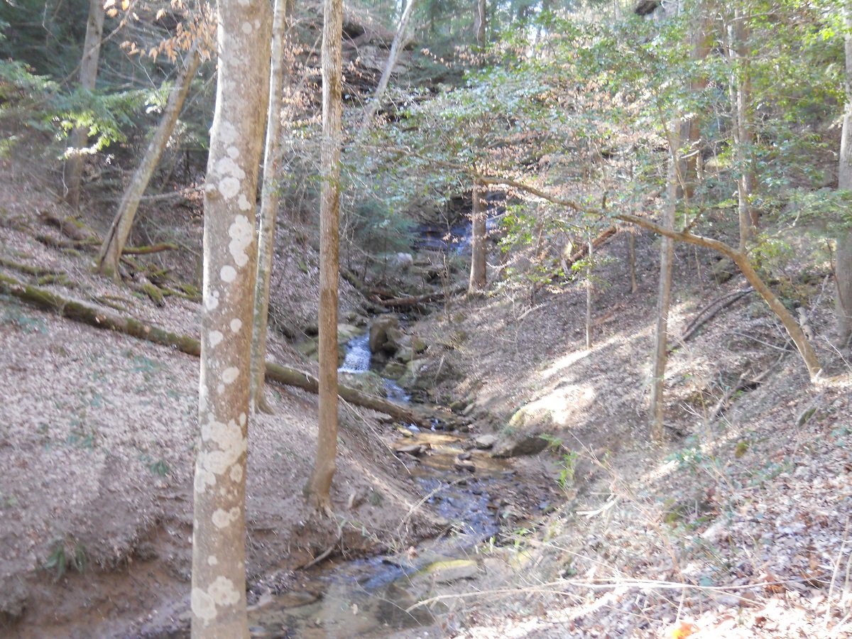 The first quarter mile was very difficult. Several feeder creeks made the hiking a muddy and slippery affair. Not muddy enough to cake our boots, but just enough to make traction a concern. Having to meander and extra 50 yards up a creek bank to cross and then back down again was disconcerting.
This was probably the lowest time for my spirit. It was getting near 3:00pm and we still had two miles to go to reach our campsite. The night before, I had trouble with the zipper of the tent door and wanted plenty of daylight to examine it for repairs.
We had just finished a difficult passage over a muddy creek, when a young fellow with two dogs came hiking our way. We were very relieved when he told us that he hikes the trail on our side regularly and the worst was over. He said it was dry and sandy the rest of our way. He was right!! Donna said that sometimes we entertain angels unawares and that God may have put him there at that time just to encourage me. He did!!
 We reached the junction with FS209 and headed west. Our campsite goal was to reach Fall Creek Falls, which we did with plenty of daylight left. The sites were few and far between, so we were there only a few minutes before a father and son team from Clinton, MS walked up. We had met Jim and Cliff heading the opposite way on the FS224 trail early that morning. They had made the loop through East Bee Branch falls.
We squeezed over and made enough room for their tent. The visit was enjoyable, as we learned Cliff’s in-laws live in our town and attend church with one of my co-workers. Cliff is finishing law school and Jim is a real estate agent. It was great to see a father and son team spending time together. Thanks to Cliff for sharing his water filter pump with us, so I didn’t have to break mine out. I could tell he was a very experienced backpacker.
We all retired early. The temperature only dipped in the 40’s, but for some reason, this night I got chilled and had to put on a pair of socks and wool cap.
Day Three
The next morning, I presented Jim with a small flint and steel fire starter he had admired the night before. He had never used one and found it remarkable. I explained that, by weight, it was the thing to have. I keep a small prescription bottle filled with Vaseline soaked cotton balls. A small spark is all it takes to have a 60-second burning flame for starting campfires.
Before we parted ways, he presented Donna with a light-weight self-inflating mattress. He said he was upgrading and thought she would enjoy a little more comfort.
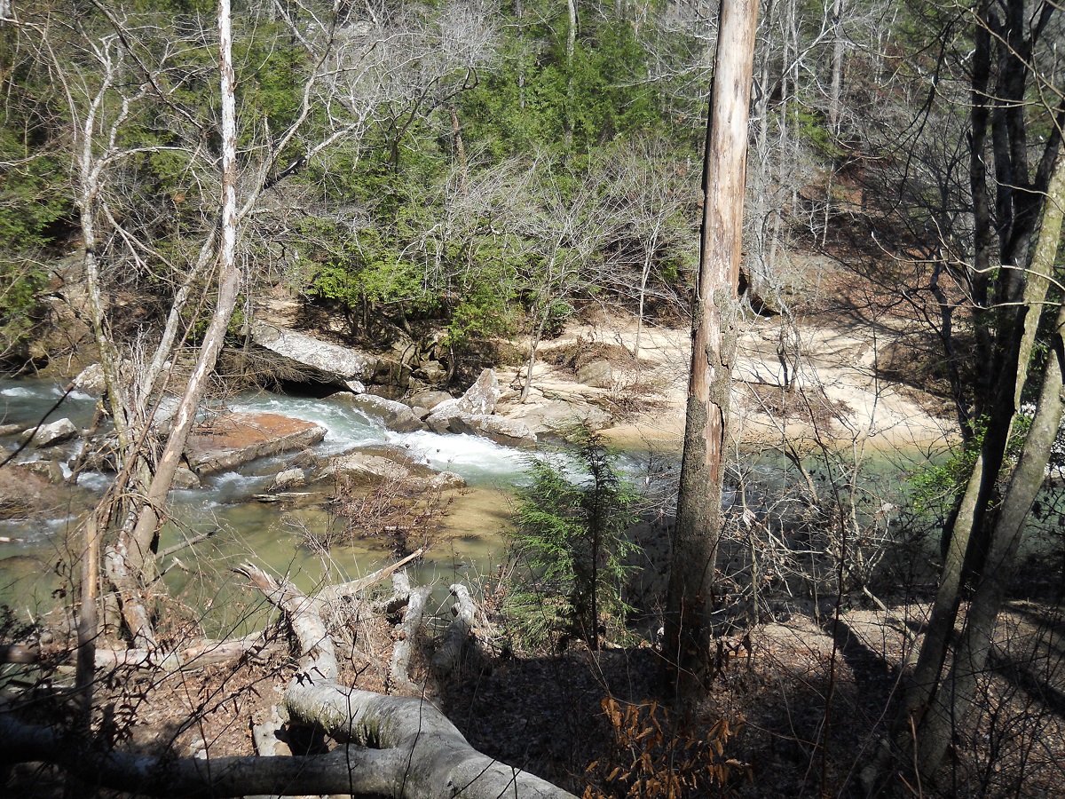 By 11:30, we reached the marker designating where we would recross the Sipsey and head southwest on FS202 toward the car. Another couple had just crossed and was standing on the opposite bank. Following their advice, we changed into our shorts and easily waded through the two-foot deep water. It was still cold, but overnight, the water level had dropped almost a full foot.
We dried off and had a lunch of trail bars and chicken noodle soup. Again, chocolate bars for dessert. For the first time, I used our water filter system for fresh, clean water.
The first half-mile of FS202 was pure misery on our already spent bodies. We could only manage 100 feet or less before having to stop and rest. The ascent had to be at least 30 degrees of incline. Just when we thought we had reached the top, there was another top just before us.
After an hour of pacing, we finally made it. The trail opened up to a beautiful hemlock forest with what was an old wagon road. Deep in the middle of the forest, we were surprised to find the top half of an old pick-up truck. We guessed it has been there since the 30’s or 40’s.
We met two fathers and there young sons heading down to the river for a three day trip. The boys were about 6-7 years old and already, dad was carrying one of the boy’s packs. They had two dogs with them. I didn’t understand their wisdom in bringing their boys along, as rain was in the schedule (yep, it rained the next day).
 Near the end of the trail, we took a “packs off” break to explore two old graveyards, Johnson Cemetery. On one side of the trail were 11 markers. On the other side were around 30. Most headstones were nothing more than large rocks, but some had obviously been hand carved and poorly written. The birth dates were from the early to mid-1800’s. The latest death year I saw was 1903. I think I’ve read somewhere that an annual day is set aside for maintenance. It was obvious that the graveyard is well maintained.
Another 30 minutes of hiking and we arrived back at the parking lot, a very welcome sight for very tired bodies. We stopped at the Haleyville McDonald’s for a delicious Filet-O-Fish meal…large size, of course.
Thanks for your travel log & photos of your backpacking in the Sipsey. I did some when I was younger with pals & I miss it now I don’t have the stamina to do that kind of thing anymore. It brought back sweet memories.